
Below the Surface
LIDAR VS RADAR VS SONAR: Which is the Sewer Inspection Champion?
When it comes to sewer inspections, there’s no one-size-fits-all technology. Multi-sensor inspection equipment, for example, leverages unique combinations of tech to deliver various data points about the condition and structural integrity of your sewer system.
In many cases, MSI incorporates some of the most powerful tech for surveying underground, including:
- LIDAR - Popular in products like SoLID FX, which was developed for large diameter pipes 30-inch and up
- RADAR - Used in GPR for detecting utility systems underground
- SONAR - Popular in setups like Combined Analog TV & SONAR (CATVS)
We often get asked: which is the best tech for sewer inspections: LIDAR, Radar, or SONAR? Read more to learn the differences.
What’s the Difference Between LIDAR, RADAR, and SONAR?
LIDAR, RADAR, and SONAR are all similar technologies, but they provide different metrics that are ideal for different tasks. Let’s explore basics on what makes each one unique.
What Is LIDAR?
LIDAR stands for Light Detection and Ranging. LIDAR sends out laser pulses and tracks how long it takes for the light to return. With that data, LIDAR can then create 2D and 3D models of the surrounding environments.

What Is RADAR?
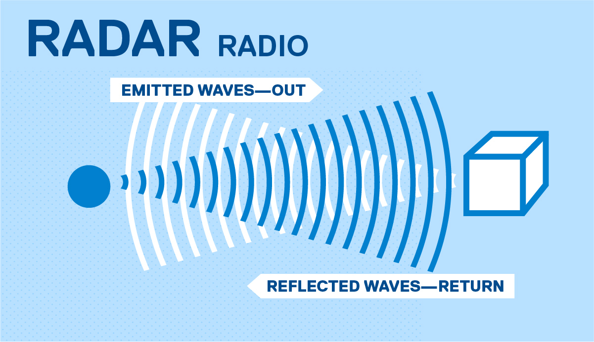
RADAR stands for Radio Detection and Ranging. By sending out radio waves and tracking their return, RADAR can determine the distance, speed, and direction of surrounding objects.
What Is SONAR?
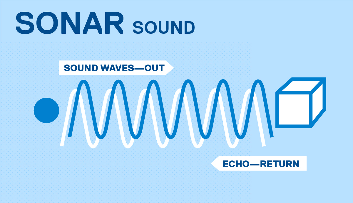
SONAR stands for Sound Navigation and Ranging. Commonly used underwater or in pipelines with lots of water, SONAR emits sound waves and listens for the echo to determine distance and shape of a nearby object or structure.
Comparing LIDAR, RADAR, And SONAR In Sewer Inspections
Although LIDAR, RADAR, and SONAR work essentially the same way (each one emits a pulse of some sort and then collects data based on that emission), they’re used in different ways within sewer inspections.
Here’s how they can (and can’t) benefit you:
1. LIDAR
LIDAR uses laser light to measure distances by bouncing beams off surfaces and calculating the time it takes for the light to return. In sewer inspections, LIDAR is valued for its high-resolution, 3D imaging capabilities, which allow technicians to create detailed maps of tunnel interiors, pipe shapes, structural conditions and at times pipeline location —without the need for physical contact.
Here’s what makes LIDAR so useful:
- It provides accurate measurements even in large or irregularly shaped pipes.
- It’s effective in dry or semi-dry conditions where visual access is available.
- It’s useful for detecting structural deformation, corrosion, or blockage risks.
2. SONAR
SONAR in the sewer works by sending out sound waves and analyzing their echoes to map environments. In sewer systems, acoustic SONAR is especially effective in submerged or murky conditions where visibility is low and LIDAR cannot function properly as laser waves cannot penetrate the water surface.
Here’s what makes SONAR so useful:
- It can operate in fully submerged pipes or water-filled environments.
- It identifies sediment buildup, flow obstructions, and pipe wall degradation.
- It’s often used in tandem with LIDAR to provide a full above- and below-waterline view.
3. RADAR
Although RADAR is similar to LIDAR and SONAR and is popular in aviation, meteorology, utility system detection and location and other STEM fields, RADAR is not commonly used in sewer inspections because:
- RADAR is less effective in water.
- RADAR provides lower resolution for surface defects.
- RADAR is more sensitive to conductive materials and certain soil types that could block signals.
Instead, ground penetrating RADAR (GPR) is better for surveying an area around a pipeline. Municipalities commonly rely on GPR to identify voids and sinkholes in surrounding soil, and then develop a comprehensive plan to overcome these obstacles.
Find LIDAR and SONAR In CUES Products
Find the ideal technology for your municipality by reviewing our equipment. From mainline inspection technology to camera transporters, you have the resources necessary to document your infrastructure.
If you have questions, contact us!