
GraniteNet Software

GraniteNet GPS Backpack Mapping Kit
|
Collect GPS coordinates with a ‘hands free’ operation to conduct asset inspections and perform data entry while using a mobile PC! * Note: Laptop PC is not included. |
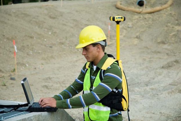 |
The CUES GPS Backpack Mapping Kit allows field users to collect GPS coordinates with a ‘hands free’ operation to conduct asset inspections and perform data entry while using a mobile PC. The GPS Backpack Mapping Kit works with both the GraniteNet (and Granite XP) Asset Inspection & Decision Support Software, in conjunction with the Granite ESRI module, to provide valuable locating and positioning solutions. The GPS Backpack Mapping Kit provides the ability to display and record Sewer (Manhole & Lateral Assets), Storm, Fiber, and Gas Pipeline coordinates from a GPS receiver and transfer this information seamlessly to GraniteNet (or Granite XP) to map the location of these assets. The kit includes a Trimble® GPS Pathfinder® ProXT™ receiver for a complete turnkey solution.
| Used in conjunction with the ESRI Module, the GPS Backpack Mapping Kit facilitates the capture and identification of the GPS coordinates, thereby developing and updating yourGIS layers! The system Includes patent-pending technology and the ability to map laterals to avoid crossbores! | 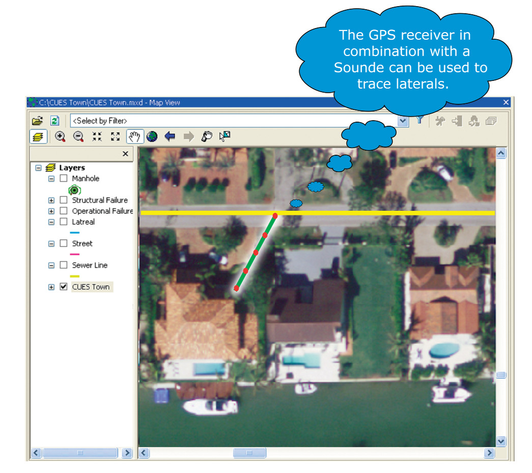 |
Features & Benefits
- Display and obtain the GPS coordinate(s) for the following assets:
- the single coordinate of the Sewer (lateral clean-out, lateral at the main, etc.), Storm, Gas, and Fiber Nodes
- GPS coordinates of the Main or Lateral Assets (coordinates will be captured based on the precision of the GPS receiver (e.g. WAAS, SBAS, etc.)
- the single coordinate of a specific observation
- Estimate a coordinate for an intermediate location based on the known coordinates of the nodes, footage, and lengths of a line.
- In the Granite software, view the current state and coordinate that’s transmitted by the GPS receiver in real time to the software.
- The GPS Backpack Mapping Kit supports the NMEA-0183 compatible GPS receivers.
- Gather GPS coordinates and estimate depth using optional built-in sonde within the camera to plot “No Dig” line traces.
- Use either a serial cable or Bluetooth® to connect the Trimble® Pro 6T™ receiver to the PC.
- The GPS Pathfinder ProXT receiver can be used to capture real-time coordinates for specific municipal assets.
DOWNLOAD THE BACKPACK MAPPING KIT BROCHURE
To learn more about the Wireless GPS Mapping Stick and how it can prevent tragedies and save lives, contact CUES.
Interested in Learning More? |
||
| ABOUT US | CONTACT US | |
| CUES is a multifaceted organization engaged in robotic R&D, new product design and engineering, hardware manufacturing, vehicle assembly, software engineering, professional services consulting, sales, training and dedicated customer support. The company has evolved, driven by the needs of its customers who demand to have one, responsive company be the focal point for all of their wastewater, stormwater, and water management needs. | 3600 Rio Vista Avenue, Orlando, Florida 32805 Phone: (407) 849-0190 Toll Free: (800) 327-7791 Fax: (407) 425-1569 Email: salesinfo@cuesinc.com |
|
| OUR PARTNERS | ||
 |
 |